Tornado Warning — Kent, DE — Aug 20, 2026
NWS PHI · ETN 25 · National Weather Service warning
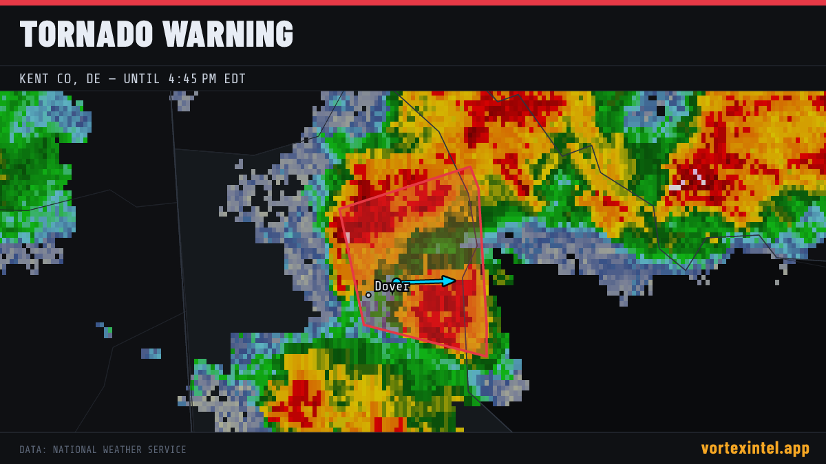
Event Summary
The National Weather Service office PHI issued a tornado warning at 20:35 UTC on Aug 20, 2026 covering Kent, DE. The warning was in effect for 11 minutes, ending at Aug 20, 2026 20:46 UTC. At the last radar check, the storm was located near 39.16, -75.35, moving east at about 28 mph.
Timeline
- Issued
- Last updated
- Ended
Counties Affected
Storm Reports
| Time | Location | County / State | EF | Remarks |
|---|---|---|---|---|
| 1 S Marydel | Kent, DE | Unrated | A tornado occurred in Marydel beginning along the east side of Grygo Rd... about a quarter mile south of the intersection of Mahan Corner Rd... taking down several tree (PHI) | |
| Hazlettville | Kent, DE | Unrated | A brief tornado occurred just east of the community of Hazlettville... primarily impacting a farm and adjacent fields along Bryants Corner Road. The tornado began in a (PHI) | |
| 2 N Wyoming | Kent, DE | Unrated | A tornado formed over the open fields west of Wyoming Mill Rd near Riverside Rd... scarring the crops before moving to the tree line east of Wyoming Mill Rd... snapping (PHI) | |
| Dover | Kent, DE | Unrated | Trained spotter reported a rain wrapped tornado on the ground... flying debris. (PHI) |
Preliminary local storm reports (SPC) within the warned area window — subject to revision after NWS surveys.