Tornado Warning — Grant, WV — Jul 21, 2026
NWS LWX · ETN 21 · National Weather Service warning
Event Summary
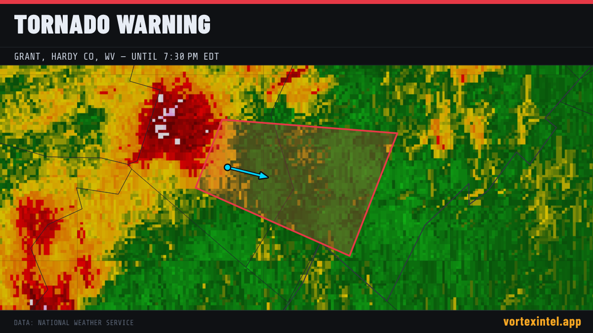
The National Weather Service office LWX issued a tornado warning at 23:05 UTC on Jul 21, 2026 covering Grant, WV; Hardy, WV. The warning was in effect for 27 minutes, ending at Jul 21, 2026 23:32 UTC. At the last radar check, the storm was located near 38.96, -79.17, moving east-southeast at about 29 mph.
Timeline
- Issued
- Last updated
- Ended
Counties Affected
Storm Reports
| Time | Location | County / State | EF | Remarks |
|---|---|---|---|---|
| 3 SSE Seneca Rocks | Pendleton, WV | Unrated | Multidirectional tree damage. Large trees uprooted... large limbs snapped on the 400 block of Thunder Rd near Seneca Rocks WV... consistent with rotation signature note (LWX) | |
| 2 SE Ruddle | Pendleton, WV | Unrated | Pendleton County Emergency Manager relayed tree damage consistent with tornado damage which corresponds to an eye witness account of a tornado. Damage started on Kiser (LWX) | |
| 3 N Timberville | Rockingham, VA | Unrated | Multidirectional tree damage. Large trees uprooted... large limbs snapped on the 19300 block of Mechanicsville Rd near Timberville VA... consistent with rotation signat (LWX) |
Preliminary local storm reports (SPC) within the warned area window — subject to revision after NWS surveys.