Tornado Warning — Allendale, SC — Oct 10, 2026
NWS CHS · ETN 9 · National Weather Service warning
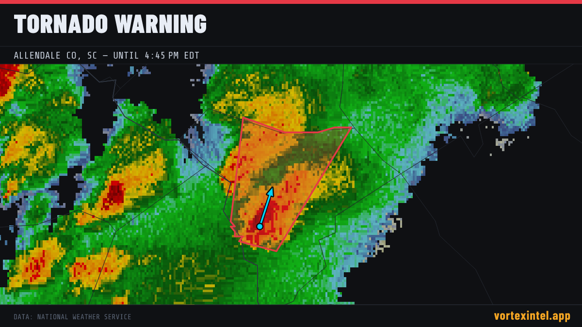
Event Summary
The National Weather Service office CHS issued a tornado warning at 20:27 UTC on Oct 10, 2026 covering Allendale, SC. The warning was in effect for 19 minutes, ending at Oct 10, 2026 20:46 UTC. At the last radar check, the storm was located near 32.96, -81.41, moving north-northeast at about 24 mph.
Timeline
- Issued
- Last updated
- Ended
Counties Affected
Storm Reports
| Time | Location | County / State | EF | Remarks |
|---|---|---|---|---|
| 3 N Appleton | Allendale, SC | EF1° | NWS Survey Team confired an EF-1 tornado in northern Allendale County. A tornado touched down in the wooded area between Miller Creek Road and Yackin Road... rapidly mo (CHS) | |
| 3 N Appleton | Allendale, SC | Unrated | 911 call center reported numerous trees and power lines down along Miller Creek Rd. Damage was likely due to a tornado. Time was estimated via radar data. (CHS) | |
| 3 NNE Appleton | Allendale, SC | Unrated | Tornado crossing Miller Creek Rd on live stream... which resulted in downed trees and powerlines. (CHS) | |
| 1 WSW Kline | Barnwell, SC | EF1° | NWS storm survey team confirmed an EF-1 tornado in southern Barnwell County. A tornado developed south of Boiling Springs Rd... east of Shepherd Rd.... moved to the nor (CAE) | |
| 1 WSW Kline | Barnwell, SC | Unrated | Storm spotters showed video of tornado on the ground west of Kline. Radar confirmed debris as well. (CAE) | |
| 2 NNW Kline | Barnwell, SC | EF1° | NWS survey team confirmed an EF-1 tornado in Barnwell County. A tornado developed along Hwy 278 south of Mount Olive Cir... then continued north into the City of Barnwe (CAE) | |
| 3 NNW Barnwell | Barnwell, SC | Unrated | Storm spotters showed video of tornado on the ground near highway 37. Radar confirmed debris as well. (CAE) | |
| 5 SSW Elko | Barnwell, SC | Unrated | Storm Spotters reported tornado northwest on Barnwell along 278. Radar confirmed debris as well. (CAE) |
Preliminary local storm reports (SPC) within the warned area window — subject to revision after NWS surveys. ° = rating parsed from the NWS damage-survey text quoted in the SPC report narrative (derived, not an official F-scale entry).